What the hazard maps show
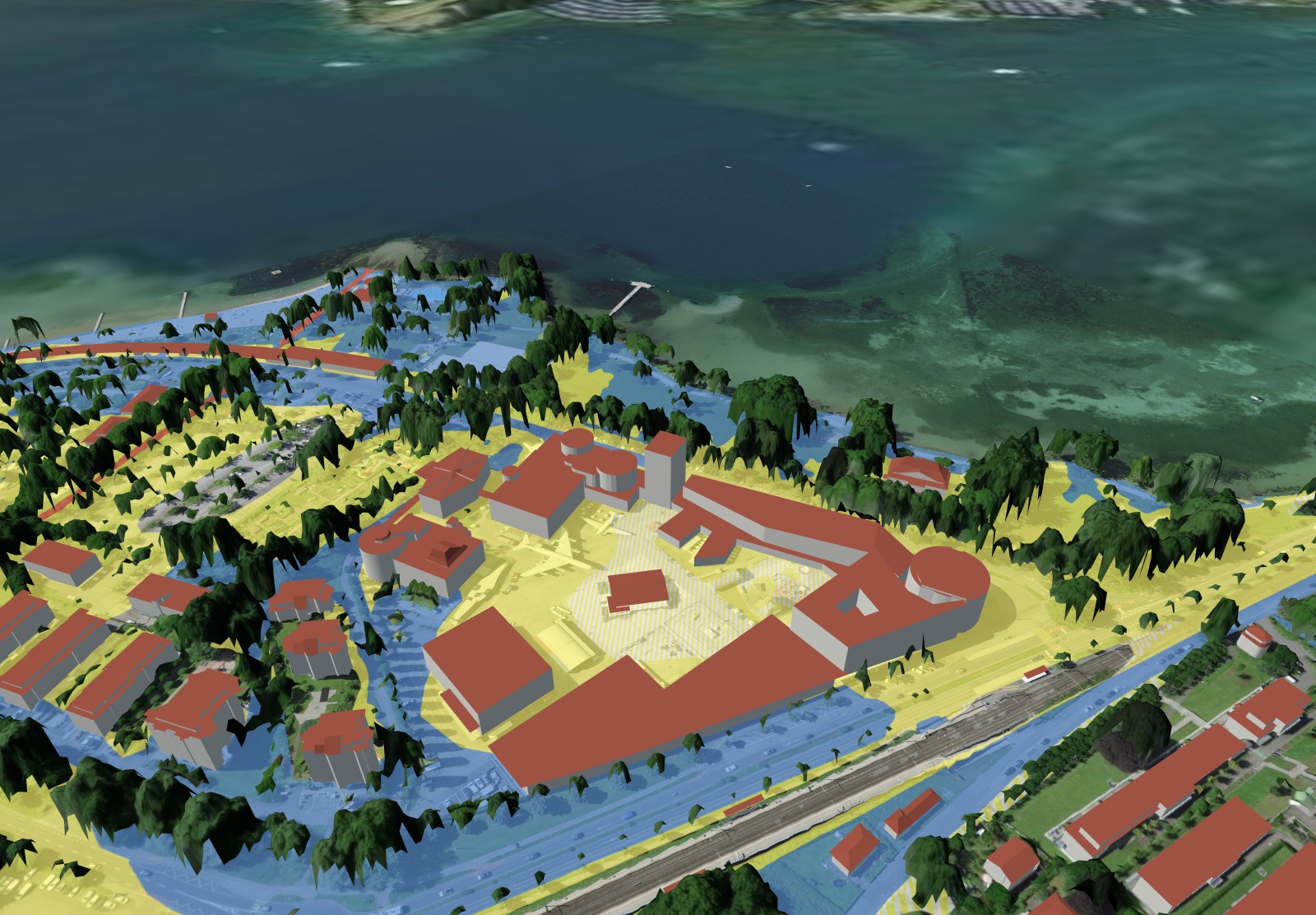
The cantonal hazard maps classify every area by hazard level, separately for each process: flooding, landslides, falling processes such as rockfall, and avalanches. The colours are the same throughout Switzerland:
| Colour | Hazard | Meaning |
|---|---|---|
| Red | significant | People are at risk even inside buildings. As a rule, a ban on building residential buildings. |
| Blue | moderate | Building is possible with conditions, for example protective measures on the building. |
| Yellow | low | Indication of a hazard, usually without building conditions, but relevant for the cellar, underground car park and insurance. |
| Yellow-white striped | residual hazard | Very rare events, for example extreme flooding. |
What applies in a zone is determined by cantonal law. In a blue or red zone, it is worth talking to the municipality and the cantonal building insurance before buying.
More than the hazard map
- Surface runoff: The federal map shows where rainwater flows over the terrain during heavy rain, even far away from any stream. A large share of flood damage happens this way, and hazard maps do not cover it.
- Earthquakes: The federal subsoil classes describe how strongly the ground amplifies vibrations. They are decisive for new buildings and conversions.
- Hail: MeteoSwiss shows the hail hazard by hailstone size. For roofs, blinds and façades, this is a matter of insurance and materials.
- Groundwater: The groundwater occurrence and heat use maps show whether a borehole heat exchanger is possible and how high the water table is.
Where the maps are available
The hazard maps belong to the cantons. SunPlot shows them for 23 cantons directly at the property, with source and data date. Nidwalden and Obwalden have not yet given their approval; the canton of Vaud charges fees and is not included. Surface runoff, earthquakes, hail and groundwater come from the Confederation and are included throughout Switzerland. Before you buy, the checker shows you what is available for your address.
Short answers
Where can I see whether a house is in a hazard zone?
In the canton’s hazard map. SunPlot overlays it on the 3D model of the address for 23 cantons and states the level at the house: red significant, blue moderate, yellow low, yellow-white residual hazard. Plus surface runoff, earthquakes and hail from the Confederation.
What does the blue zone in the hazard map mean?
Moderate hazard. Building is possible, usually with conditions such as protective measures on the building. Which conditions apply is determined by cantonal law; the municipality and the building insurance can provide information.
Is surface runoff the same as flooding?
No. Surface runoff is rainwater that flows over the terrain during heavy rain, even with no stream nearby. The hazard maps do not cover it, which is why SunPlot shows the federal map for it.